Functional usage of Maps and information projected on it: traffic info
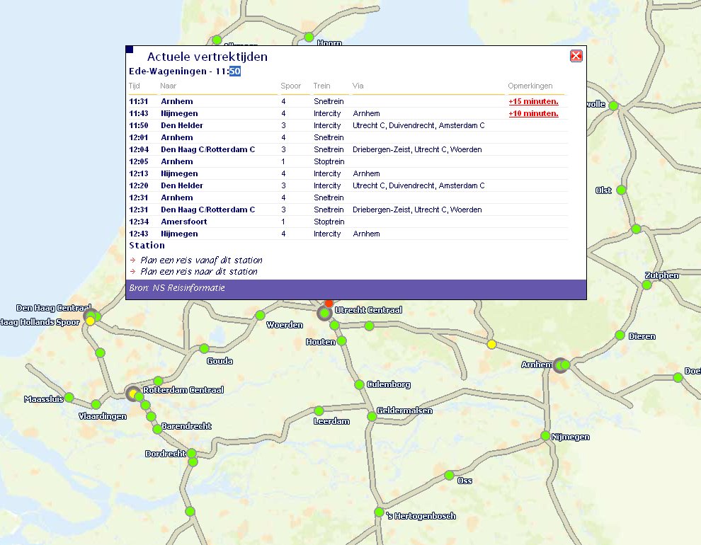
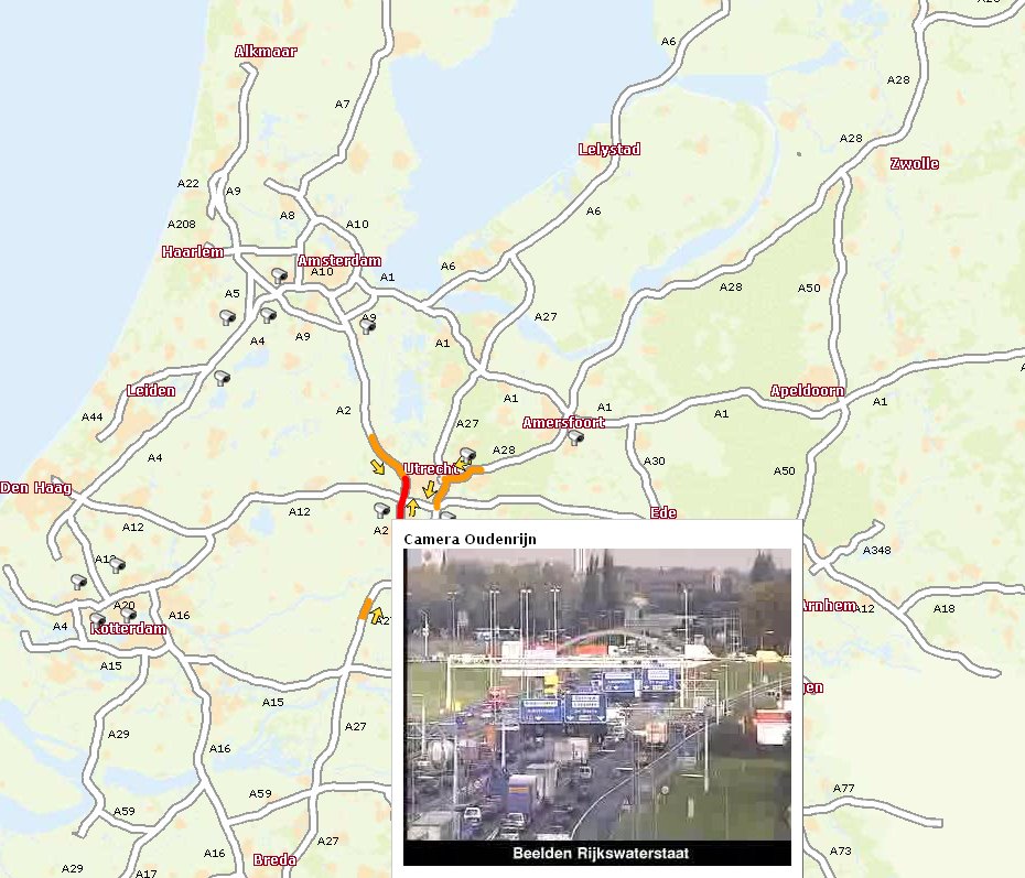 There are a great many examples of using GoogleMaps or other map browsers to project geo-referenced or geo-tagged information. Many of them are not really functional at all, just nice to see or fun. Traphic made something really useful. You should know that The Netherlands is extremely dense traffic wise. It is extremely high on the list of inhabitants/square meter on a global scale, hence our main roads are jammed and even rail roads are jammed due to the maximum usage of it. I something goes wrong, gigantic jams occur. Their map of the main roads even shows images from the camera's installed at key crossings and entrances/exits. The rail road map shows dots which are trains, the pop-up I opened in the picture below is the yellow dot train on the left, the pop-up gives its delay information. I think it's brilliant!
No comments:
Post a Comment