Showing posts with label Maps. Show all posts

Sunday, October 19, 2008

The role of Local 2.0 in Enterprise 2.0?

Last Friday I attended The Next Web Salon for the second time in a row. Got to meet interesting people and got triggered by the 10 minute presentation by Michael Bauer. Michael Bauer is a local internet expert and CEO of Koano. Michael's presentation, though very short but nevertheless good, was about the future of local. Local as in: Search, Mapping, Ontology, International, Social, Network.

Imagine a web app that allows me as a citizen of Amsterdam to find the kind of places I know and like in Amsterdam when I travel abroad. E.g. Vondelpark in Amsterdam, is similar to, Central Park in New York. A recommendation system based on things you know well near your 'home' to find things near your 'locus' (the place you are).
What would be the impact of such a mechanism in an enterprise context? In large organisations where it's beyond your possibilities to know everything, but you do know your thing. So, what if the coordinates are not geographic, but organisational. Your place in the value chain, business process, organogram, stakeholder network, ... In the pit of my gut I feel there is something good about this... (Photo taken by Anne Helmond)

Tuesday, July 03, 2007

What Was Where?

Today the Beta version of www.watwaswaar.nl was presented in Utrecht. The site's back-end was built by Toutatis. Wat Was Waar?, meaning "what was where?" is a website for the broad public showing the map of The Netherlands with all places clickable leading to a list of contents linked to that place in a certain period of time. From 1932 'till today. Currently the contents are aerial photo's, old city designs and information about house or land owners. The map viewer shows really clear and detailed maps, based on vectorized maps. Toutatis developed a smart pre-load mechanism, ensuring maps are shown really fast. Lots of ajax is used. Compliments to Toutatis and WatWasWaar.

Wednesday, January 03, 2007

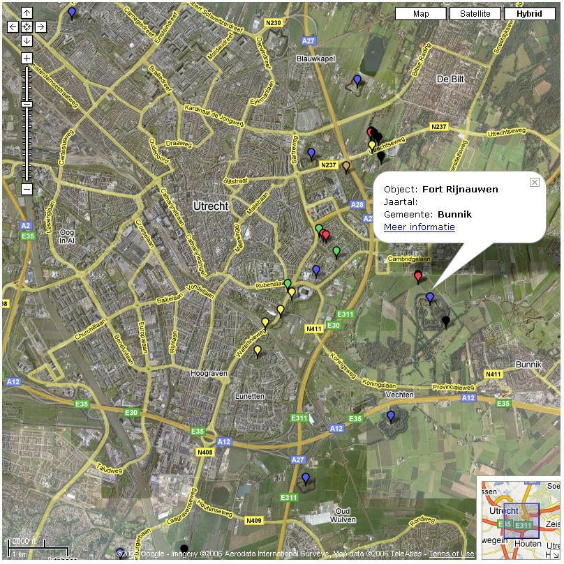
Mashup of GoogleMaps and Military History

January 3rd, 2007, 10 past midnight. I just finished the first major step in developing a demonstrator in GoogleMaps. 1000 objects are depicted on a map. The objects are part of a historically important infrastructural project in The Netherlands, until today it's still the largest project undertaken. Larger than the Deltaworks, larger than Betuwelijn, larger than HSL, ... The objects were built as a defence mechanism previous to to first world war. By inundating a large area of the country the enemy could be brought to a stand still (in the pre-aircraft years).

Tuesday, November 28, 2006

World Map as means to depict statistics

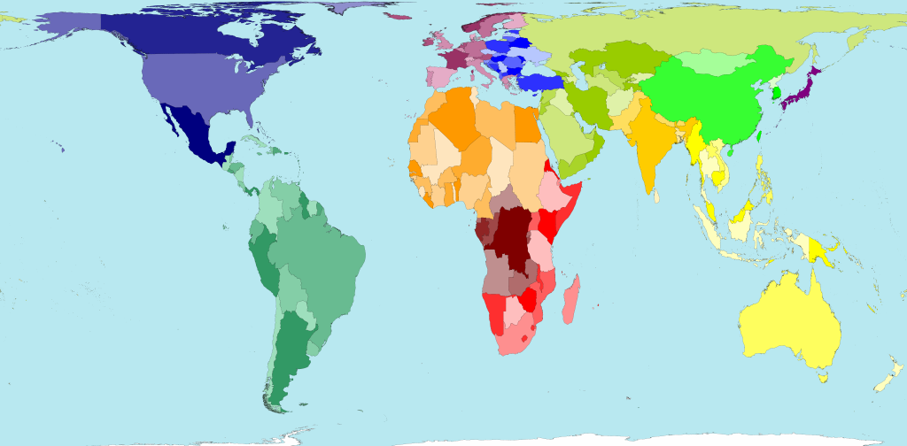
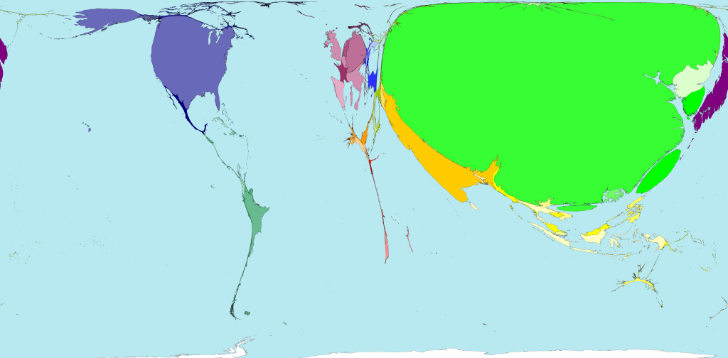
Compare the following 4 maps: worldmap, container ports, nuclear power and aircraft flights. Land area Land area The total land area of these 200 territories is 13,056 million hectares. Divided up equally that would be 2.1 hectares for each person. A hectare is 100 metres by 100 metres. Container ports Container ports There are more shipping containers loaded and unloaded off the coasts and rivers of China, than travel to or from all other territories put together. Nuclear power Nuclear power European territories dominate the list of the top ten producers of nuclear electricity. In 2005, Sweden was in top place, and France second position, in terms of power generated per person living there. Aircraft flights Aircraft flights If the total distance flown by all aircraft passengers was divided equally between eveyone living in the world, we would each fly 317 kilometres a year. In fact some people fly thousands of kilometres a year, whilst others have never been in an aeroplane. As seen on WorldMapper.

Thursday, November 02, 2006

Functional usage of Maps and information projected on it: traffic info

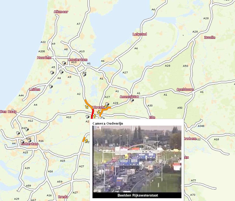
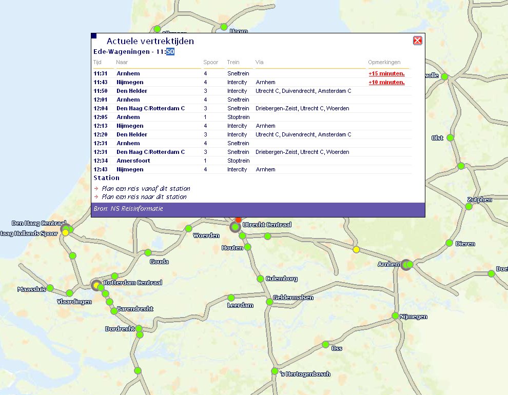
There are a great many examples of using GoogleMaps or other map browsers to project geo-referenced or geo-tagged information. Many of them are not really functional at all, just nice to see or fun. Traphic made something really useful. You should know that The Netherlands is extremely dense traffic wise. It is extremely high on the list of inhabitants/square meter on a global scale, hence our main roads are jammed and even rail roads are jammed due to the maximum usage of it. I something goes wrong, gigantic jams occur. Their map of the main roads even shows images from the camera's installed at key crossings and entrances/exits. The rail road map shows dots which are trains, the pop-up I opened in the picture below is the yellow dot train on the left, the pop-up gives its delay information. I think it's brilliant!

Monday, October 30, 2006

I have been working on a GoogleMap overlay

GoogleMaps is an interesting phenomena, Google supplied brief documentation on the API, nevertheless lots of people, not just geeks, started to work on it and step by step the API grows. I guess that that is what web 2.0 is all about. Starting with some sort of Beta and let the community work on it to the next Beta. Frankly I enjoyed my hours with the API documentation and places like Mapki, a wiki on GoogleMaps. The result is a map based search entry for documents.